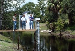
Ambitious water quality study could guide development for years
Eric Gurr, the city’s storm water utility manager, has designed a water quality study on a grand scale. He’s identifying the waterborne pollutants that enter and leave his city of 47,000 residents (and up to 6 million tourists per year) and building a model to predict their future movements.
Kissimmee is crossed by a maze of low-velocity streams and man-made canals, and dotted with natural and man-made lakes. The city is perched on the shore of Lake Tohopekaliga, a famous bass fishing destination. The local watersheds ultimately connect to the Gulf of Mexico and the Atlantic, as well as the fragile Everglades.
To understand what’s happening within city limits, Gurr took on a data-intensive mission: sampling from 20 stations around Kissimmee for an array of 40 to 50 contaminants and water quality parameters.
“We want to isolate which pollutants are going to be important in the future, where they are coming from, and what the ultimate discharge is,” he said.
Race against time
Gurr races like a man who’s running out of time. In the public works conference room, his laser pointer jumps across an aerial composite photo shot in 2004, showing wooded tracts that are now subdivisions and commercial developments. TMDLs, or total maximum daily loads, loom over most of the city’s water bodies.
“You’re looking at expenditures that can be in the tens or hundreds of millions of dollars,” said Eric Livingston, chief of the Florida Department of Environmental Protection’s Bureau of Watershed Management in Tallahassee, Fla. “You want to be sure that you have as much accurate data as you can when you’re creating your Basin Management Plan.”
Gurr figures the $1.4 million budget of his study—covered mostly by grants—will be just a fraction of what the city will save by carefully targeting its water quality efforts.
Data first
Before jumping into action, Gurr—a long-time hydraulics and hydrology consultant—wants to see some data first, to make sure engineering solutions are on target.
“If you don’t know what the problem is, how do you solve it?” he asked. “Once I identify what the pollutants are, I’ll be able to track where they’re coming from. I can isolate them before they interact and dilute. Then we can sit down to decide whether we could approach them with baffle boxes, small vortexes, or leaf screens. It will cost less money to do these small interventions, and they’ll have less impact on the systems and residents.”
Integrated solution
Part of keeping the big project under control is integrating several components of the hardware and software through a single supplier.
At the heart of the system, a suite of YSI 6600EDS multiparameter sondes gather and transmit data on dissolved oxygen (DO), turbidity and pH every 15 minutes, providing a detailed look at water quality – right down to diurnal cycles and the effects of storm events.
At 11 sites, SonTek/YSI Argonaut SL (side-looking) flow meters provide stage and velocity data through the same YSI EcoNet wireless data uplink as the YSI sondes. At the other nine sites, which feature extremely shallow water, Gurr and SonTek installed concrete sumps to house the YSI 6600EDS sondes and Argonaut SW (shallow water) units to keep an eye on flows that often slow to a trickle.
Once he has sifted through the vast array of variables gathered during the four-month initial collection process, Gurr said he plans to zero in on the most pressing parameters for future monitoring efforts.
The second phase of the Kissimmee project is running the data through the Danish Hydrology Institute’s MIKE SHE software, which melds a surface water model with a 3-D groundwater model.
Gurr said, “With the software, you can track a pollutant and find out the hydrology going into it, the hydrology when it gets there.”
Being prepared
Gurr plans to have his data collected and put through the first, skeletal run-through of the model in October 2006. Fine-tuning could take another year, and is expected to help identify locations for 12 more sampling sites.
In the meantime, Gurr expects to have a good grasp of the mounds of data he’s collecting to help write targeted, science-based Basin Management Plan for local TMDLs.
“The more information we have about our own water bodies and discharges, the better off we’re going to be,” he concluded.
