Bird’s Eye View
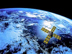
When most people think of satellites, they think about the exploration of outer space, distant planets, satellite internet or even cellphones. But many satellites—the Union of Concerned Scientists estimates there are 1,738 active satellites orbiting the Earth—are pointed back at our planet, often to research weather and ocean patterns, and to relay other observations from Earth’s upper atmosphere to scientists on its surface.
The uses can go even further, however. Lauren Guy, chief technology officer and cofounder of Utilis, used his master’s degree in geophysics and his bachelor’s in hydrology to develop a method for finding leaks in water infrastructure using satellite imagery. James Perry, vice president of U.S. sales for Utilis, said Guy’s algorithms have been the cornerstone of Utilis’ business since it started in 2014.
“While everyone was tending to look towards Venus and Mars and trying to test long-range satellites and seeing if using radar would allow you to find water on those distant planets, he had the brilliant idea of simply turning the satellite around to look for water on Earth,” Perry said, noting Guy did this during his studies.
In the five years since the company started, it has used satellites and computer technology to identify locations of leaks in municipal water systems to save operators and municipalities time and resources in finding and addressing them.
Analog Vs. Digital
Traditional leak detection methods use acoustic sounding devices to find the source of leaks in a system. This methodic process can be slow and time-consuming if the operators are not certain where in the system a leak resides. And where concrete pipe is used instead of metal pipe, acoustics can become trickier to analyze.
Those methods still are effective tools for operators, and Perry said a marriage of those and satellite imagery can reduce time spent looking for leaks where they are unlikely to be found. Satellites are advanced enough that they can use radar to see 10 ft beneath the Earth’s surface—depending on soil and ground factors—and identify drinking water sources based on salinity levels.
“The really interesting thing [Guy] had done was develop an algorithm to filter out and isolate down the dielectric content, kind of the salinity level, of waters and was able to filter out all water types and isolate that down for drinking water,” Perry said.
The spectral wavelength images Utilis uses are public images. In particular, Utilis uses L-band wavelength because of its nature to reflect its signal off water sources back to the remote sensing device on the satellite, similar to an X-ray.
“There’s a measurement for all waters, and it really has to do with the chemical makeup of the waters. Outside of pure water, things that are added to water either naturally or man-made, [can be identified],” Perry said. “When you think of drinking water, you think of the chorines and chlorides that are added to it that purify it and make it safe for drinking. That affects the salinity level and that salinity level is unique to drinking water versus fresh water, ice, snow, that kind of thing.”
Tackling Tennessee Troubles
In Whitwell, Tenn., a town northwest of Chattanooga, municipal water leaks had become an issue, driving up non-revenue water costs. Two Tennessee American Water operators were using sonar in an attempt to find all the leaks when the superintendent learned about Utilis’ technology. By implementing it, the operators could search for leaks where there was higher probability to find them and fix the pipe.
Using the algorithm, Utilis surveyed the entire network and created a snapshot of likely drinking water deposits. Those images then are laid over the municipal pipe network to further narrow where in a system potential for leaks may be found.
When all this data is combined with the algorithm to isolate the drinking water, Perry said, the location of water sources are accurate to within a 150-ft buffer. As such, traditional leak detection methods are still necessary to find the exact location of the leak in the network, but those searches are more fruitful because of the satellite imagery.
“We’re giving them points of interest to go investigate,” Perry said. “So instead of trying to do 4,000 miles of a big utility, we’re sending them to clusters of areas where we identify leaks. Then these acoustic listening teams can go pinpoint exactly where the leak is.”
These leaks, Perry said, can run for months, sometimes even years, before they are detected by a utility. They are a keen interest, as fixing them can limit non-revenue water and improve a utility’s bottom line.
Wider Implications
Naturally, this technology can benefit utilities looking for leaks and ways to shore up their infrastructure, but the algorithm can be further tailored. As such, it could be used to find potable groundwater deposits in areas where water is scarce. Additionally, Perry said Utilis is looking for ways it could be used for wastewater facilities.
“[The technology] certainly is not a one-hit wonder,” Perry said. “There’s opportunities to look for leaks and identify the signature of wastewater, which is a big problem, as well. Certainly areas where there are natural waters just underground are important also for sewage and wastewater teams and utilities because there are federal mandates for intrusion as well as extrusion.”
Even identifying soil moisture that is leaking into systems, he said, could be beneficial for wastewater utilities. Finding leaks for gas utilities also is a point of interest for Utilis as it continues to develop its technology and algorithm.
“This product that we have today is literally just scratching the surface,” Perry said, noting that as more satellites are launched into orbit and as the algorithms are further refined, leak detection with this method will improve rapidly.
