VDC Software is Changing Water Project Construction
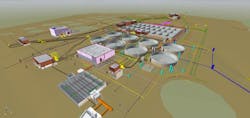
Digital tools are the heart of construction management. They are used to track schedules, budgets, RFIs, punch lists and more. Over the last 10 years, water project design engineers have been involved with the extensive conversion from 2D flat drawings to 3D digital design tools. The benefits of converting to 3D included easier visualization for project owners, clash detection and more accessible digital models.
Eventually, schedules (4D) and resource loading (5D) were added to the models. With the addition of 4D and 5D models, the ever-expanding world of Building Information Modeling (BIM) morphed into the broader umbrella of Virtual Design and Construction (VDC). The benefits for the contractor and owner include reduced rework, fewer change orders, better schedule adherence, and stronger budget control.
McCarthy Building Companies utilizes Procore for construction management software. The universal platform allows teams to streamline every process from pre-construction to closeout. However, there are also some new digital tools that integrate with Procore being utilized by McCarthy's national Water team. The technologies – Revizto, StructionSite and Trimble Site Vision – provide added value for owners by allowing teams to collaborate more efficiently, review and document better, and demonstrate more detailed modeling.
Revizto: A One-stop Shop for Design Information
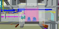
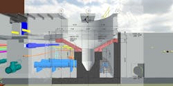
Bridging the gap between design and build, Revizto helps bring to life projects. The primary focus of the cloud-based software is to provide a BIM collaboration platform for 3D and 2D workflows that enables the teams and all project stakeholders to have the details that 2D provides and the understanding that 3D provides on one screen. Enhanced communication is also a great function of the tool.
Revizto unifies BIM intelligence and makes it immediately accessible and actionable for the entire project team. With Revizto’s advanced Issue Tracker, team members can identify and manage model-based issues in the 3D space and 2D sheets, including addressing clash groups. Revizto provides unified access to a project’s data both for 2D and 3D workflows, so anyone can use it depending on project requirements.
“Revitzo’s unified collaboration platform makes us leaner and more effective, and it houses all design deliverables in one place. It’s effectively a one-stop shop for design information,” said Alex Belkofer, CM-BIM, VDC director at McCarthy. “It also has version control, clash detection, chats and reporting capabilities that are really useful for collaboration. Additionally, the ability to access and collaborate with the entire stakeholder group drives rapid communication.”
Real World Revizto Uses
Prior to implementing Revitzo on projects, McCarthy used four different programs to achieve what Revizto does in one, which makes issue tracking seamless. For example, on a major wastewater plant expansion in the Midwest, Revitzo was utilized in early constructability reviews. The construction team was able to create notifications for preconstruction team on means and methods and supply chain issues. As a result, the preconstruction team was able to delineate scope between packages.
The team also tracked RFIs for the designer through this platform, including issues like clashes, inconsistencies in call-outs, accessibility, and value engineering ideas. Instead of going through the process of making mark-ups in bluebeam and transferring them to an excel sheet, then receiving responses in excel and adding additional information in excel, and then, at the next milestone, attempting to determine how that comment applied to the new set of drawings, members of the team were able to track everything through model revision overlays and the issue tracking chat, keeping things clear and neatly in one place.
Now in construction on this project, laser scans have been uploaded to make sure that what was built matches up with what will be built. Additionally, the McCarthy team is conducting in-model reviews of lift and lay drawings, and is are considering documenting pipe testing and other quality related inspections through Revizto and its link to Procore.
For another project, also located in the Midwest, McCarthy is doing the same thing except that the engineers are using the model. The two engineers on the project are working on separate scopes and Revizto is collecting information from both to create one federated model so the team can quickly identify and resolve any clashes between the designs. Also uploaded are topographical maps and civil 3D data for a more precise vision of what is going to happen underground on-site.
Finally, the schedule on this one is quick with several GMPs – team members have been able to exchange information rather quickly and efficiently to communicate more effectively about GMP delineations. The team receives scheduled published models from the design teams on a bi-weekly basis for up-to-date trending and cost models, and they get comments on constructability for incorporation in design as they are made.
Ultimately, the value proposition for Revizto is that an integrated team is better coordinated, and the software supports a higher level of trust, transparency and collaboration among teams working on complicated water infrastructure projects.
StructionSite: Captures Organized 360-degree Views
StructionSite enables contractors to capture photo documentation of jobs in 360-degrees, and the photos are automatically organized by date and floor plan location.
“We send out a project engineer to walk the site and capture photos at specified points. StructionSite overlays the photos on construction drawings or on a Google map, which allows us to know exactly what we’re looking at within a site plan and see how construction progresses over time,” said Zach Wheeler, VDC manager at McCarthy.
Project teams find this visual representation especially useful, since many team members and owner representatives are not out in the field every day. It is also helpful in terms of reinforcing a culture of safety, since the 360-degree pictures keep plant staff out of construction zones while still enabling views of progress to date.
StructionSite has also been used on water projects in the Midwest. For one, it came in very handy with creating maintenance of plant operations (MOPO) as well as for cost modeling when the entire project team could not be in the field each day. Team members were able to have meetings about the MOPOs or means and methods by pulling up the 360 photos for the location in question quickly and comprehensively with team members located across the country. It also allowed members access to it any time on any day.
The tool provides a solution to what has previously been a common issue arising from the limitations of project site photos. Many have experienced the scenario where project photos are taken by someone on the project team, believing that the photos captured everything necessary for the team to work from, only to realize that the problem that needs to be addressed involves something that is out of sight in the photo, or the image is is unclear, or the roof or the floor were not captured, or that one cannot tell exactly where the piping goes, or any other myriad reasons that result in sifting through thousands of photos trying to find the one that is needed. This does not happen with the StructionSite tool’s 360-degree photography.
“We’ve only been scraping the surface of what we can do in terms of collaboration with these integrated tools, and it’s already significantly improved how we collaborate,” Belkofer added.
Trimble SiteVision: Accuracy for Augmented Reality
Another technology that McCarthy’s Water team is piloting is Trimble SiteVision, which introduces a user-friendly augmented reality to the site. It effectively brings data to life, enabling owners to better visualize and explore complex information with more accuracy.
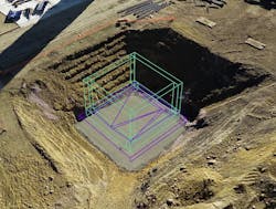
“There are a lot of tools that claim to provide augmented reality, but the concern has always been the level of accuracy. Construction – and with water infrastructure projects in particular – requires a high level of precision,” said Dave Moran, a project manager at McCarthy who has been piloting the Trimble SiteVision implementation on water projects. “Trimble SiteVision utilizes GPS registration, which is extremely accurate. We can see exactly where things should be installed using a 3D model augmenting the field conditions. This will ultimately improve quality by catching any issues in advance of actual construction.”
Since the majority of construction quality and safety issues on water projects occur at or near the wall-pipe penetrations and pipe continuations, or with electrical duct banks, SiteVision allows for one to accurately see where wall pipes need to be installed and how the pipe connects inside and outside of the building. This drastically reduces rework of issues related to wall-pipe and allows pipe fitters on both sides of the wall to plan and prepare appropriately. For duct banks, it reduces the chances of hitting a live duct bank and improves the ability to install new duct banks in live facilities (a rehab that is occurring more and more on water projects) without affecting existing power and other underground infrastructure that keeps the plant running.
Pioneering the VDC Frontier
These software technologies –Revizto, StructionSite and Trimble Site Vision – represent the next frontier in VDC capability on water infrastructure projects. Although these tools may seem very complex, they are actually very user friendly and easy to use.
It is important to embrace change as an industry and be okay with learning new things, while being patient through the process of change so the industry can continue to innovate. These tools are going to make contractors, engineers and utilities better partners. They will provide more value to water projects and improve both quality and safety.


